Applications: Quantifying Landfills gas emissions, Management of Uncontrolled Landfills, Monitoring of Illegal Dumping, Environmental modeling, Economic and ecological impacts
Benefits: Advanced image interpretation, Precise update, Rapid data collection, Clear visual results
USERS: Local Governments, Auditing Companies, Agencies of Control, Environment Departments
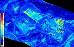
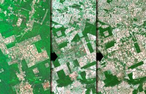
The use of Aerial photography and satellite images allows simple interpretation to make a quantitative estimate of how landfills change in time. The possibility of acquiring a series of images of the same area over a period of time, allows us to monitor the evolution of a landfill. Many times landfills are declared closed, whereas in reality they are not.
Visibird provides a valuable instrument for monitoring of landfills, getting a precise update of the area without having to go to the actual location of the landfill. At the same time it is useful to analyze the environmental restoration process.