Applications: Catchment flood management, Mudslides disaster management, Land degradation analysis, Biodiversity conservation, Hydrological models
Benefits: Sustainable development, Rapid data collection, Ability to monitor change
USERS: Public Agencies, Agencies for the protection of environmental resources
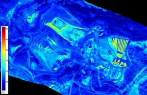
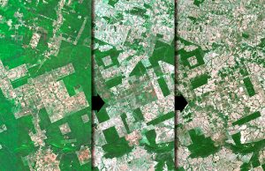
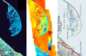
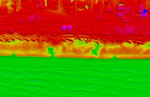
Human actions and natural processes can change in short time a land space and these changes are able to be detected by remote sensed instruments. But the effects related to these slow processes could take devastating environmental results such as deforestation and soil erosion quite hard to recover and the costs and consequences not always are evaluated,
Visibird helps to provide remote sensing images and data from areas over concrete a period of time. The analysis and interpretation of this data allow us to estimate the percentage of land degradation, providing a valuable tool for political authorities and environmental agencies to encourage sustainable development and monitor the phenomenon of land erosion and deforestation due to natural or human activities. That’s why it is important to be able to monitor and understand these areas being deforested and understanding the negative global effects like climate change, loss of biodiversity, ozone depletion, survival of species and risk to aboriginal populations.