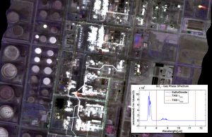
Applications: Ecological Analysis and Synthesis, Fish Assessments development, Water Quality analysis, Protecting Shorebirds and Benthos, Atmospheric Gas Regulation, Recreation & Tourism impact
Benefits: Reduced Field work, Clear visual results, Detailed information
USERS: Public Agencies, Agencies for the protection of aquatic resources, Tourist Industry
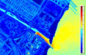
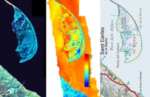
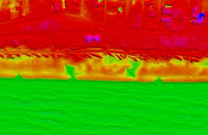
Estuaries are among the natural areas the most biologically productive ecosystems on the planet. These ecosystems act as filters for terrestrial pollutants and provide protection from flooding. A lot of people visit the estuaries as a tourist destination needing management and guiding. Image interpretation from remote sensing together with in-situ data and the analysis of the diverse spectral information on visible, near infrared and thermal bands allow us to create a land use map of these fragile ecosystems and to create a classification of the different types of habitats and ecological areas of importance.
Visibird provides a valuable instrument for monitoring estuaries and areas of ecological importance , being able to identify areas of great ecological value for conservation as well as being able to determine areas more suitable for new developments.