Project Title: The Development of a Platform for the Prospective Modelling of processes of urbanization on coastal areas (ModelCosta)
Funding body: The Spanish Ministry of Science and Innovation (MCIN)
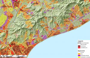
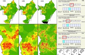
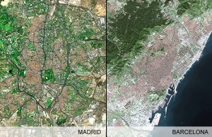
Project description: The project consisted of the development of a platform to enable the evaluation the processes of urbanization already carried out as well as anticipating the expansion of the same processes in a near future (2010-2025). This would permit contrasting up to what degree the process of urban sprawl had become generalized in the geographical region of the Iberian Coast, as well as the characteristics of the different models of land occupation, which was seen to be essential to assist administrators and urban planners a like in the spatial planning decision making process. The main project objectives:
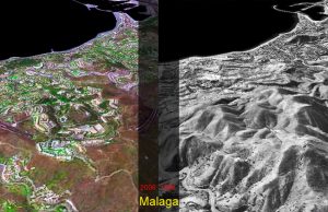
- Develop a geometric correction for the historical aerial images and their comparison with contemporary satellite imagery;
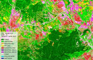
- Define the land use classes through the analysis of satellite imagery;
- Use application of cellular automata in forecasting models for spatial planning;
- Analysis of processes of dispersion and fragmentation, as well as the phenomenon of sprawl;
- Develop a platform for visualizing the overall results of the project.
The project is submitted jointly by the Universitat Politècnica de Catalunya (UPC) through its Centre de Política de Sòl I Valoracions (CPSV) – Spain and e-GEO – Research Centre for Geography and Regional Planning, Faculdade de Ciências Sociais e Humanas FCSH, Universidade Nova de Lisboa – Portugal