Project Title: The urban expansion of the metropolises of Southwestern Europe. INTERREG IIIB European Union Program- EURMET
Funding body: EU Initiative INTERREG III-B, Operational Programme for Southwestern Europe
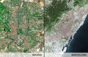
Project description: The project sought to examine the (re)location of economic activities in the peripheries of the metropolitan urban regions of the South Western European spatial territory, using a joint methodology for the delimitation of morphological centers and metropolitan peripheries. The case study metropolitan regions comprised Madrid and Barcelona in Spain; Lisbon and Porto in Portugal; and Bordeaux, Toulouse, Montpellier and Clermont-Ferrand in France. The main project objectives:
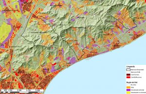
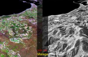
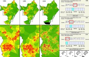
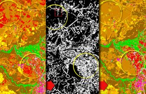
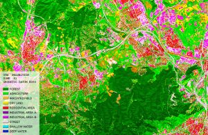
- Develop a balanced methodology aiming at identifying the built urban boundaries in the case study-cities using segmentation and object-oriented classification of SPOT 5 images;
- Identify the social and economic contents of the above mentioned urban boundaries and to analyze the dysfunctions linked to the lack of adaptation of the management boundaries to the “actual” limits of the built space;
- Recognize to what extent spatial planning policies are adapted to the diffusion processes of peripheral urbanization.
The project is submitted jointly by the Centre Interdisciplinaire d’Etudes Urbaines (CIEU) – Université de Toulouse-Le Mirail – France, e-GEO – Research Centre for Geography and Regional Planning, Faculdade de Ciências Sociais e Humanas FCSH, Universidade Nova de Lisboa – Pprtugal, Centro de Política de Suelo y Valoraciones (CPSV) – Universidad Politécnica de Cataluña – Spain and Institut Cartogràfic de Catalunya (ICC) – Spain.